Health & Fitness
Strong Storm System To Impact Area Tuesday, Bringing Low Snow Levels
A strong storm system out in the Northern Pacific will dip down into Southern California by Tuesday, with low snow levels and thunderstorms.
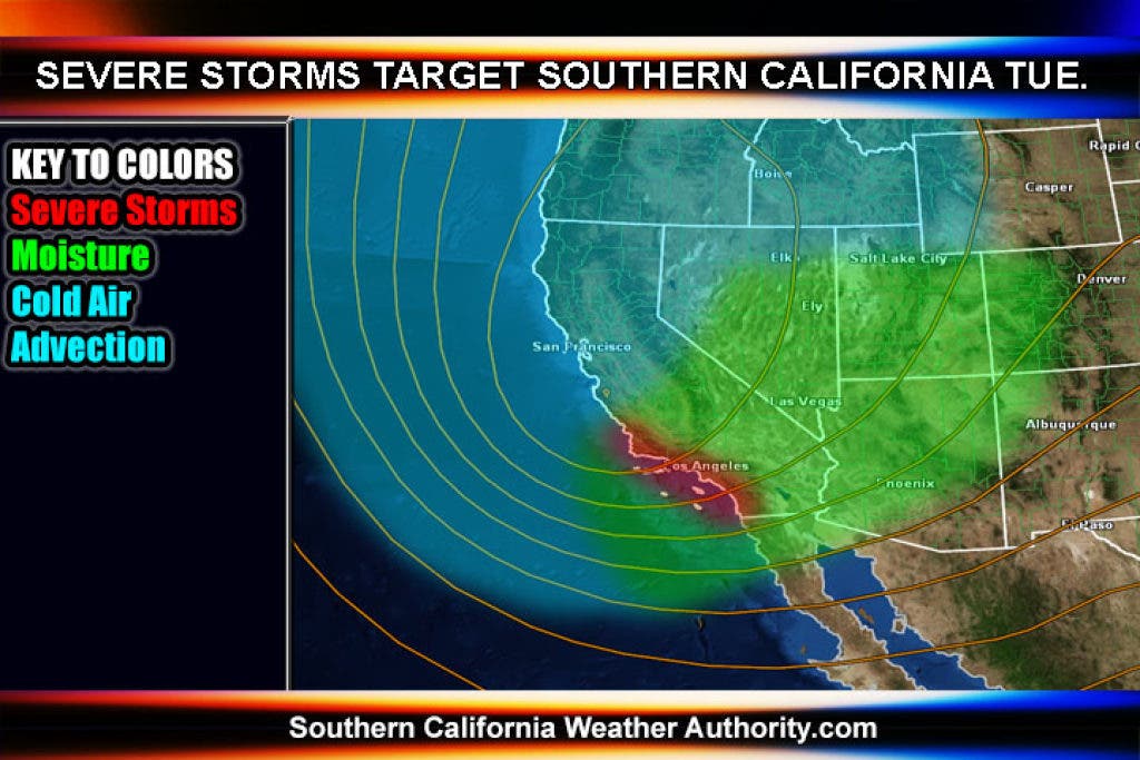
A strong storm system out in the Northern Pacific will dip down into Southern California by Tuesday. Latest track has it bringing in low snow levels, which could bring pass level snowfall once again like the last storm that hit.
Snow levels should be around 4,000 feet Tuesday morning, dropping to the pass over the afternoon and evening hours. The freezing level will remain that way all night, so expect Tuesday night into Wednesday morning to have temperatures well below freezing.
In addition to this, thunderstorms will be likely, with hail to start out with before the flakes try to start falling.
As we move toward Tuesday, expect the official weather advisories to be issued at SCWXA.
The SCWXA Forecast Product is a specialty product issued by Southern California Weather Authority.com - Southern California's Public Choice for Weather Alerts.
For SCWXA Facebook Visit - https://www.facebook.com/SouthernCaliforniaWeatherAuthority
Get SCWXA Weather alerts via email - http://www.southerncaliforniaweatherauthority.com/emaillist.html


