Health & Fitness
Freeze Ending Tuesday With Gusty Winds Starting Monday Onward Followed By a Warm-Up
The Freeze will come to an end on Tuesday, with gusty wind conditions starting overnight tonight.
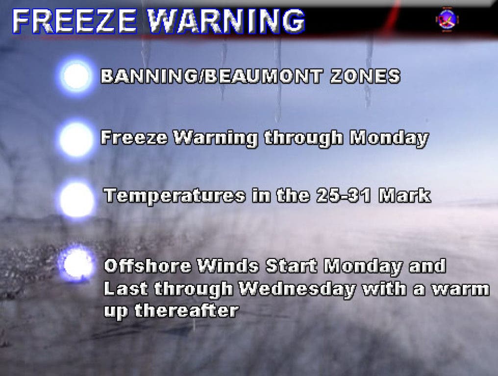
The Freeze will come to an end on Tuesday, with gusty wind conditions starting overnight tonight. SCWXA Freeze Warning remains in effect tonight and Monday night as temperatures hit the 20s again.
Temperatures on Friday night hit 25 degrees, getting extremely close to SCWXA Hard Freeze Warning criteria. Temperatures on Saturday were around 27 degrees. Tonight, we'll get around 28 degrees and on Monday night around Freezing. Tuesday night should be back over 40 degrees with gusty winds.
A storm system is going to move east of the area, bringing the pass areas a northeast wind starting Monday morning. These winds will strengthen through then and Tuesday, becoming more easterly. The east wind favors the pass location and gusts well over 40 mph look to be likely. This Santa Ana Wind Event could be prolonged, lasting through about Wednesday.
Since this is a prolonged Santa Ana Wind Event, temperatures will warm up some as the air continues to dry. This dry air will cause a moderate fire risk in the area.
After the wind event, temperatures will climb to above average by the end of this week and a nice weekend is on tap. This will last a whole week as a ridge of high pressure parks near the area.
The SCWXA Forecast Product is a specialty product issued by Southern California Weather Authority.com - Southern California's Public Choice for Weather Alerts.
For SCWXA Facebook Visit - https://www.facebook.com/SouthernCaliforniaWeatherAuthority
Get SCWXA Weather alerts via email - http://www.southerncaliforniaweatherauthority.com/emaillist.html


